Beyond the coastal Greek cities of the Aegean shore, the Thracian hinterland formed a world with its own dynamics and a distinctive relationship to the landscape. Archaeological research reveals a society that cannot be reduced to a mere “periphery,” but one that actively engaged with its natural environment in ways that reflect both tradition and adaptability. Within this interior landscape rural sites, extensive burial grounds in the lowlands, upland sites and settlements, roads and paths, drystone forts and open air ritual sites formed a cultural zone that shows the dynamics of local societies that endured until Late Antiquity embodying a spiritual continuity that absorbed elements of the Greek and later Roman world while retaining a strong local character.
The Thracian hinterland was thus a landscape of constant negotiation—between tradition and innovation, between local identities and external influences. It was never static or “traditional” in a simplistic sense, but a space defined by mobility, interaction, and adaptation. Communities integrated new realities into older frameworks, ensuring that local agency remained central to the shaping of both social life and cultural expression. In this way, the hinterland played a decisive role in producing the distinctive archaeological record of Aegean Thrace, where landscapes themselves became active participants in history.
Residential landscapes & political organization
Archaeological findings from the Thracian hinterland document a particularly complex world, where social and political structures are closely intertwined with monuments and landscapes. A characteristic example is the monumental burial complexes (e.g., Sveshtari, Golyama Kosmatka, Kazanlak), which express the presence of powerful elites and the ideology of power. These tombs often reveal elements of intercultural influences, combining local Thracian features with Persian and Greek models. A dense network of fortified settlements and elevated sites (e.g., Sboryanovo, Seuthopolis, Perperikon) demonstrates the need for territorial control and the spatial organization around centers of power.
Trade, road and river networks
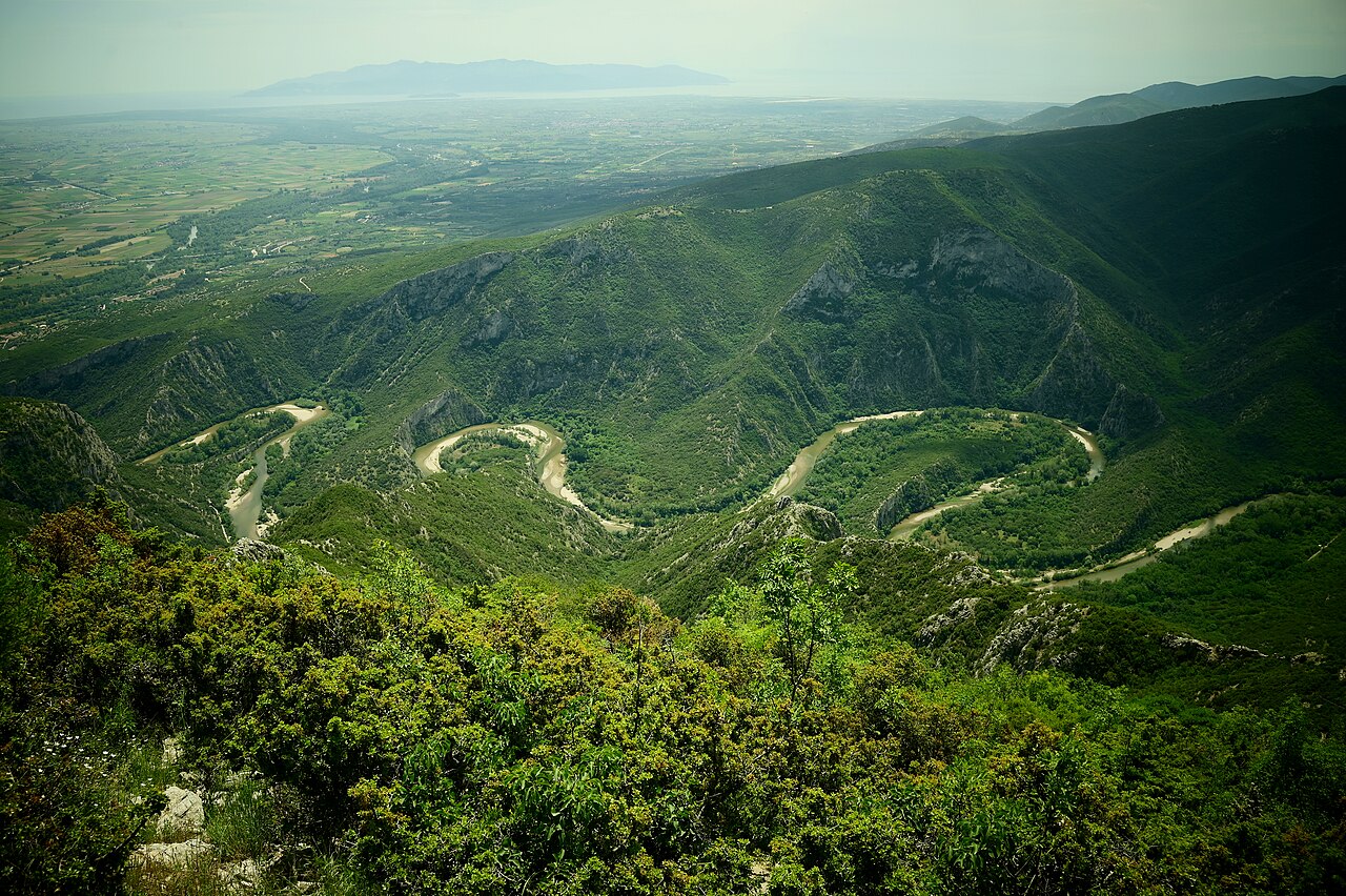
The issue of communication routes and natural corridors in the hinterland is of particular importance. River valleys and mountain passes served as main axes for the movement of people and goods, while forts and strategically located settlements played a role in guarding and controlling these passages. In some cases, archaeological data indicates the existence of gathering points or stations that could serve military or commercial purposes. The so-called “Pistiros inscription” documents the legal framework that characterized the commercial relations of the time, as well as transport routes. The site of Vetren, for which an identification with ancient Pistiros is proposed, highlights the connections between the Thracian coast and the hinterland. Within this context, the valleys of the rivers Nestos, Evros, and Ardas appear to have functioned as natural axes linking the Thracian interior with the coastal areas.