The Rhodope Mountains form the northern backdrop of Aegean Thrace, stretching nearly 190 kilometers from the valley of the Nestos to that of the Evros. Rising sharply above the coastal plain, with peaks often surpassing 1,000 meters and reaching almost 2,000, the range creates a natural divide between the North Aegean world to the south and continental Thrace to the north. Divided by the Kompsatos River into western and eastern zones, the Rhodope is a landscape of striking contrasts: high ridges and deep valleys, dense forests and fertile river plains, remote upland pastures and vibrant villages.
Rodopi is a mountain range that stretches north of the prefectures of Drama, Xanthi, and Rodopi, forming a natural border between Greece and Bulgaria. Rodopi is divided into Eastern, Central, and Western Rodopi and features a variety of landscapes, from mountain peaks and valleys to dense forests and rivers. The highest peak in Central Rhodope reaches 1,953 m in the Virgin Forest of Frakto. The climate, physiography, geology, and human presence have shaped a diverse mosaic of ecosystems.
The Rhodope Mountains are one of Europe’s most important biological treasures. They were not affected by the glaciers during the Pleistocene, which allowed many species from Central and Northern Europe to find refuge and survive to this day. Almost 60% of European flora is found here, with 211 rare or endangered species, including 15 remnants from the ice age and 50 endemic species. The Greek section features all vegetation zones, from Mediterranean to cold coniferous, while dense forests cover 84% of the area, hosting rich fauna and flora and maintaining complete, healthy ecosystems.
Far from being a marginal or inaccessible frontier, the Rhodope has always been central to the life of the region. Its forests, mines, rivers, and pastures provided resources that supported both local communities and wider networks of exchange. Herds grazed on its upland meadows, wood and stone were extracted for building, and mountain paths connected the coast to the Thracian interior. Even in recent memory, caravans of camels crossed its passes, echoing the ancient networks of roads that once linked Thracian settlements with the ports of the Aegean.
The mountains also held deep spiritual significance. Open-air sanctuaries, ritual sites and carved reliefs—such as the famous Mithras relief at Thermes—testify to their role as sacred landscapes, especially in the Roman period when cults like that of the Thracian Rider flourished here. Today, the Rhodope remains a place of extraordinary natural beauty and biodiversity, home to forests, rivers, and some of the last lynxes and bears of Greece. For archaeology, history, and ecology alike, the Rhodope Mountains represent not isolation, but a living backbone of Thrace’s cultural and natural heritage.
History and Culture
The Rhodope Mountain range is characterized by a multitude of defensive enclosures and fortifications. Forts such as the Kalyva fortress on the hilltop Kastro, located 9 km north of Neochori in Xanthi and in use from the Late Classical to the Roman period, stand out due to their construction. Fortified sites like the enclosures at Tsouka (Sarakini), Zarkadia (Lefkopetra), Kimmeria, Thermes, Oraio etc., are less refined in terms of construction, yet equally important for controlling the mountain passes to and from the Thracian hinterland. It has been argued that these numerous fortified hilltops, known as “acropoleis,” found on both the Bulgarian and Greek sides of the Rhodope range, represent the typical habitation sites of the Iron Age. Similar fortified hilltop sites appear across Europe during the same period. It has also been suggested that these fortified locations served the need for secure communication and the trade of portable goods in the region or functioned as religious sites. Ethnoarchaeological research conducted in the 1980s and 1990s provides some useful insight for the interpretation of these sites. Although most of these sites have not been excavated, several appear to be characterized by continuous human presence over time. Their use for military purposes during the Byzantine period does not necessarily indicate their original function.
One of the most distinctive features of mountainous Aegean Thrace is the rock art dating to the Late Bronze Age-Early Iron Age. Rock engravings depicting human figures or animals – such as those found in Roussa and Goniko in the Evros region – as well as clusters of cavities of various sizes carved into rocks in the Rhodope and Ismaros mountains (e.g., Askites, Sarakini, Myrtiski), have been interpreted as creations of Thracian tribes intended to protect shepherds and their livestock from harmful supernatural or natural forces.
Two Macedonian tombs have been identified in mountainous Aegean Thrace. One, near the village of Symbola in the Rhodope region, dates to the 3rd century BC, while the other, located between Stavroupoli and Komnina in Xanthi, is dated to 200–150 BC. Two more Macedonian tombs have been found in sites (Lagyna and Elafochori in Evros) near the foothills of the Rhodope Mountains and date back to the 4th century BC.
Near the fortified enclosure of Thermes, a relief of Mithras, the patron deity of military guilds in the 2nd and 3rd centuries, was found. It has been suggested that the location is not by chance, since this was likely the primary route used by military conscripts or units recruited in the highlands as they made their way to the great harbors of the Aegean coast. Another finding, a hoard of 900 tetrarchic coins near the village of Oraion, reinforces the idea that – at least during Roman times – mountainous routes were of considerable military importance, as were the fortresses supervising the passages and possibly serving as pay stations for military troops.
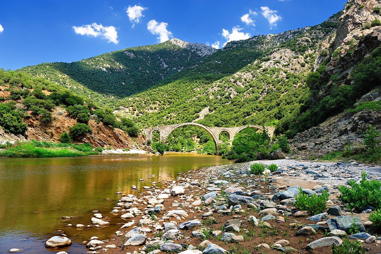
The distinctive relief of the Rhodope Mountain range, with its steep slopes, does not allow for much variety in the ways mountainous sites could communicate with one another. Byzantine and Ottoman stone-built bridges, such as the Byzantine bridge of Polyanthos or the Ottoman bridge of Xeropotamos, along with the mapped modern hiking trails, can thus contribute to a broader understanding of the human-shaped landscape of the Rhodope, within the framework of a long-term (longue durée) research perspective.